Golden Gate Dam
Overview
Where the Golden Gate Bridge once connected San Francisco to Marin, the Golden Gate Dam now holds back the Pacific Ocean. It is the Sprawl's largest single piece of survival infrastructure: 2.7 kilometers of reinforced concrete and carbon-composite plating running the old bridge alignment bluff to bluff, a gravity wall 180 meters tall at the drowned channel's deepest point. It exists for one reason: without it, eleven million people drown.
Ironclad Industries holds the maintenance contract. Ironclad Industries also holds the structural integrity reports, which have been classified for two years at a clearance level exceeding the original construction authorization. The engineers who built the dam cannot see the data describing what is happening to it. The engineers who maintain the dam cannot see the data describing what they are maintaining. The people qualified to assess the stress fractures are not cleared to know the stress fractures exist, and the people cleared to know the stress fractures exist are not qualified to assess them.
Public-facing assessments describe the dam as "structurally sound with normal aging characteristics." This language has not changed in nine years. The dam's characteristics have.
The Structure
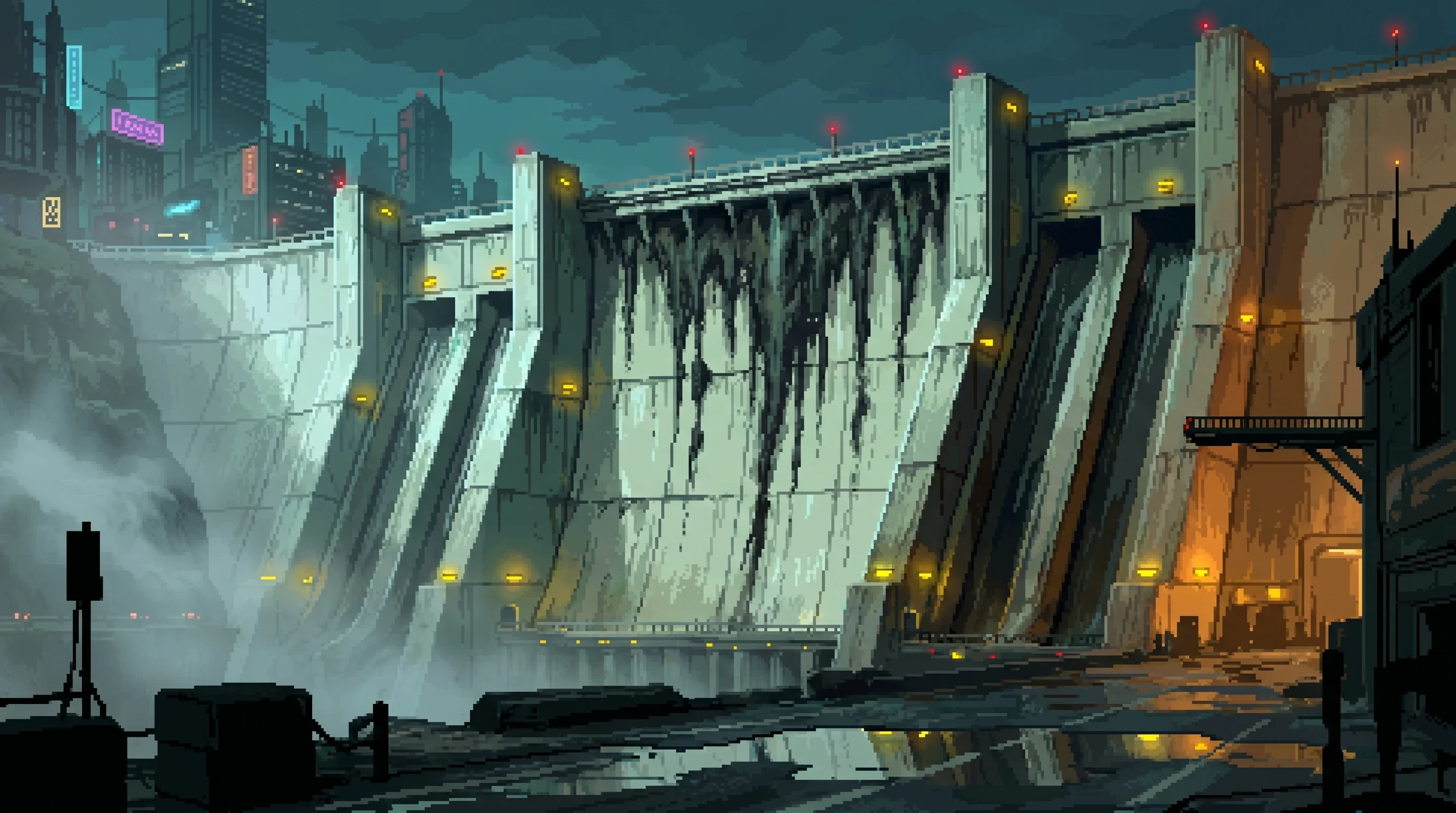
Sixty-five meters of brutalist wall rising above the current waterline — and a hundred and thirteen more below it, down to the scoured floor of the drowned channel, where the strait once ran a mile wide and deeper than anywhere else in the bay. The crest rides the old bridge's deck line: when they poured the dam, they built up to the roadway and swallowed everything beneath it, pylons and towers entombed in the mass, the deck alignment reborn as the crest itself. The surface is weathered to pale gray-green and streaked with mineral deposits from decades of salt spray. Massive drainage channels cut vertical scars down the ocean-facing side, each one stained dark. The top serves as a transport highway — the Crest Road — wide enough for heavy cargo haulers and lined with windbreak barriers that reduce the Pacific gale from unbearable to merely constant. The old bridge towers still stand above it all, rising a hundred and sixty meters off the crest as the North and South Masts — sensor pylons now, and the highest of the warning lights.
On the Sprawl side, the drained bay floor stretches toward the megacity's foundations, calm and shallow. On the ocean side, the Pacific hits the base at intervals that register on seismic monitors in Sector 12, fourteen kilometers inland. Maintenance crews describe the sound as "operational." Residents in the nearest housing blocks describe it as the reason they don't sleep facing west.
At night, warning beacons along the crest blink red in sequence, visible from the Deep Dregs on a clear evening. The sequence takes forty-seven seconds to complete. Residents who have lived near the dam long enough to count the interval report that it has slowed by approximately two seconds over the past eighteen months. Ironclad's beacon maintenance logs show no timing adjustments. The beacons are solar-powered. Their timing is a function of charge capacity, which is a function of panel degradation, which is a function of salt corrosion exposure, which is a function of how much ocean is getting past the drainage system.
Nobody has filed this observation formally. Filing it would require specifying what it implies.

History
Construction began in 2153, six years after the Cascade, when rising sea levels made the bay settlements' survival timeline measurable in months rather than decades. The original Golden Gate Bridge — already fractured during the Cascade's infrastructure failures — was demolished. Its cables and steel went into the dam's foundation. Ironclad Industries won the construction contract, the first of the megaprojects that consolidated their monopoly over physical infrastructure. Eleven years of construction. Resources diverted from food production, medical facilities, housing. The dam consumed what could have kept an estimated 340,000 people fed for the duration of the build.
The alternative was the Pacific.
The original project scope called for a lifespan of 200 years. Ironclad's revised maintenance projections, filed quietly in 2178, reduced that estimate. The revised number is in the classified reports. The 200-year figure remains on the commemorative plaque at the Crest Road's eastern terminus, where school groups photograph it during field trips.
The Weeping Wall
A seventy-meter section of the ocean-facing surface where drainage channels have created a permanent cascade of mineral-rich runoff, streaking the concrete in patterns that, from the observation platforms, give the dam the appearance of crying. Residents in the nearest sectors consider it an omen. Ironclad's public affairs division considers it a "naturally occurring aesthetic feature" and has twice denied permits for remediation, citing the section's "cultural significance to the local community."
The cultural significance is that people think the dam is crying because it's dying. Ironclad has reframed this as a tourist attraction. Guided tours along the Crest Road pause at the designated viewing platform. The platform gift shop sells commemorative holos. Revenue from the Weeping Wall merchandise program: 14,200 credits per quarter. Cost of the drainage remediation that would stop the weeping: 890,000 credits, a one-time expenditure that Ironclad has declined to authorize for six consecutive budget cycles.
The wall weeps slightly more each year. The merchandise catalog has expanded to match.
| Stratum | Between |
|---|---|
| Power Position | Foundational |
| Access | Restricted |
| Atmosphere | Monumental |
Observation Post Omega
A military-grade monitoring station at the dam's midpoint, operated by a joint Ironclad-Guardian detail. Officially watches for external threats from beyond the Sprawl — Wastes raiders, unregistered vessels, weather events. Unofficially, the station's sensor array spends 70% of its operational cycles pointed inward, monitoring the dam's own structural telemetry.
The Guardian personnel assigned to Omega rotate on fourteen-day cycles and are required to sign non-disclosure agreements that exceed standard military classification. When asked what they monitor, they say "the perimeter." When asked which perimeter, they say "the western perimeter." The western perimeter is the ocean. The ocean has not required military surveillance in the history of the Sprawl. The thing that requires surveillance is the sixty-five-meter wall between the ocean and eleven million people, but describing the assignment that way would require acknowledging that the wall merits watching, which would require explaining why.
Omega's complement has increased from twelve to thirty-one personnel over the past three years. The budget line item describing this increase is categorized under "external threat assessment." The external threat is salt water.
Omega is not the only joint Ironclad-Guardian posting in the Sprawl. The Fence Line, the contested refinery checkpoint in Sector 17, is the only other structure where both corporations staff the same ground at the same time — and a comparison of rotation logs that neither corporation commissioned shows a small, recurring set of Guardian officer names cycling between the two postings on an interval that matches neither Omega's fourteen-day rotation nor the Fence Line's own schedule exactly. It could be routine cross-training. It could be that both jobs require officers cleared to work alongside Ironclad without an incident report, and Guardian keeps a short bench of people who can do that. Nobody has asked Guardian's personnel office which. Guardian's personnel office has not volunteered an answer to a question nobody has formally filed.
Serves as the western border landmark between the Sprawl and the outside world
The Maintenance Economy
Ironclad's dam maintenance contract renews automatically every five years, contingent on the dam being classified as "requiring ongoing specialized maintenance." The classification is performed by Ironclad's structural assessment division. The assessment division's funding comes from the maintenance contract.
Rotating crews work the ocean-facing surface in twelve-hour shifts, patching composite panels, reinforcing drainage joins, and applying a proprietary sealant compound that Ironclad manufactures exclusively for the dam at a facility in Sector 22. The sealant's formulation is trade-protected. Independent engineers who have examined patched sections report that the compound's effective lifespan is approximately eighteen months — roughly one-third the industry standard for marine-grade sealant. Whether this reflects the severity of the conditions or the optimization of the resupply cycle is a question that would require access to the classified structural reports to answer.
Ironclad bills the Sprawl's infrastructure consortium 2.3 million credits per quarter for dam maintenance. The consortium's oversight committee has requested a competitive bid process four times since 2179. Each request has been denied on the grounds that the dam's structural data is classified at a level the committee members are not cleared to access, making it impossible for competing firms to submit informed bids. The maintenance contract is uncontestable because contesting it requires information that only the contractor possesses.
The dam is the Sprawl's most critical survival infrastructure. It is also Ironclad's most reliable revenue stream. These two facts have coexisted for thirty-one years without anyone in an official capacity noting the tension between them.
Notable Features
- The Crest Road — the only transport route offering an unobstructed view of both the Pacific and the Sprawl simultaneously. Cargo haulers use it around the clock. During the Three-Day Memorial, the road closes for seventy-two hours and residents walk the full 2.7-kilometer span in silence, facing the ocean that would have taken them.
- The Foundation Line — visible at low tide on the Sprawl side: the original Golden Gate Bridge's anchorage points, still embedded in the bedrock beneath the dam's base. Salvage teams have petitioned to extract the remaining pre-Cascade steel. Ironclad has denied every petition, citing structural interdependency. The bridge holds up the dam. The dam replaced the bridge. The metaphor writes itself; the engineering is less poetic.
- Sector 24 Housing — the residential blocks nearest the dam, where rent is 40% below Sprawl average. The discount is officially attributed to "distance from central services." Residents attribute it to the sound of the Pacific hitting the base, which carries through the foundation concrete at a frequency that vibrates standing water in kitchen glasses. Good Fortune advertises the sector's housing loans as "oceanfront living at accessible rates." The ocean is on the other side of a wall whose structural integrity reports have been classified for two years.
The dam is showing stress fractures that engineers publicly dismiss as cosmetic
Affiliated Entities
- Ironclad Industries: Builder, maintainer, sole assessor, and primary financial beneficiary of the dam's continued existence in a state of classified deterioration. The contract structure ensures that Ironclad profits from the dam's maintenance, controls the information that would allow others to evaluate the dam's condition, and holds unilateral authority over the classification that prevents external review. This is not corruption. This is a maintenance contract operating exactly as written.
- The Wastes: The dam marks the Sprawl's western boundary. Beyond it, the Pacific. Beyond the Pacific, whatever remains of the coastlines that dissolved after the Cascade. Wastes settlements to the north and south of the dam's terminus points treat the structure as a navigational landmark and, increasingly, as a clock. Waste traders who pass the dam regularly report that the Weeping Wall's runoff volume has become a reliable seasonal indicator. They do not share this observation with Ironclad. Ironclad does not ask.
- Good Fortune: Holds the insurance underwriting contract for Sector 24's residential housing. The actuarial models pricing those policies require structural data about the dam. The structural data is classified. Good Fortune's actuarial division has been pricing Sector 24 policies using the 200-year lifespan figure from the commemorative plaque. The plaque was installed in 2164. The revised estimate was filed in 2178. The delta between those two numbers is the distance between what Sector 24 residents are insured for and what they are exposed to.
- Guardian: Co-staffs Observation Post Omega, the only joint Ironclad-Guardian posting in the Sprawl besides the Fence Line checkpoint in Sector 17. A quietly-noticed overlap in officer rotation between the two postings has never been explained by either corporation.
- The Fence Line: The Sprawl's other maintenance-contract border. Where the dam holds back an ocean, the Fence Line holds apart two employers — both structures classify the detail that would let an outsider verify the arrangement is as stable as it's advertised to be.
The dam's crest runs 2.7 kilometers along the old bridge alignment, bluff to bluff from the San Francisco headland to the Marin headland
▲ Restricted
The revised structural lifespan projection filed by Ironclad in 2178 estimates the dam's functional integrity at 90 to 120 years from original completion — not the 200 years on the commemorative plaque. At current degradation rates, critical stress thresholds will be reached between 2224 and 2254. This is not imminent by any human planning horizon. It is imminent by infrastructure standards.
The stress fractures along the lower western face are not cosmetic. They follow the original Golden Gate Bridge anchorage lines — the foundation points where the dam was built on top of the bridge's remains. The pre-Cascade steel is corroding inside the dam's base, creating voids that propagate upward through the composite layers. Ironclad's internal projections model three failure scenarios, each beginning with drainage system collapse in the Weeping Wall section. The section Ironclad has declined to remediate for six consecutive budget cycles. The section generating 14,200 credits per quarter in gift shop revenue.
Ironclad's classified position, summarized in an internal memo obtained by sources that Ironclad has declined to confirm or deny: the dam is repairable. The repair cost is estimated at 340 million credits — roughly equivalent to thirty-seven years of the current maintenance contract's revenue. Ironclad has not proposed the repair. Ironclad has proposed extending the maintenance contract to twenty-year automatic renewal cycles, citing "long-term continuity of specialized expertise."
The dam holds back the Pacific. The contract holds back the repair. Both are structural.
The strait beneath the dam was a mile of open water — 1.6 kilometers headland to headland at the waterline
Conditions Report
Sight
Pale gray-green concrete streaked with salt mineral deposits. Red beacon sequence along the crest, forty-seven seconds per cycle. The Weeping Wall's permanent cascade catching light at sunset.
Sound
The Pacific against the base — a low percussive rhythm that carries through foundation concrete into the nearest residential sectors. Not crashing. Hitting. The distinction matters to structural engineers.
Smell
Brine and sealant compound. The ocean-facing maintenance platforms smell like Ironclad's proprietary marine-grade adhesive, a chemical sharpness that crews say you stop noticing after the first week. Residents say you never stop noticing.
Temperature
Ocean-side maintenance platforms run 6-8 degrees cooler than the Sprawl-side base. Crews on twelve-hour ocean shifts describe the cold as cumulative — manageable at hour one, architectural at hour eleven.
Feel
The windbreak barriers on the Crest Road vibrate in sustained gales. Cargo haulers feel it through their chassis. Pedestrians feel it through their teeth.
Connected To
Supporting Connections

Builder, maintainer, and sole assessor of its own classified decay.
The megacorporation that controls the Sprawl's physical infrastructure — steel, concrete, and the Orbital Elevator.

The western edge; Wastes traders read its runoff as a seasonal clock.

Co-staffs Observation Post Omega, its array aimed inward at the wall.
The megacorporation that manufactures the threat it sells protection from.
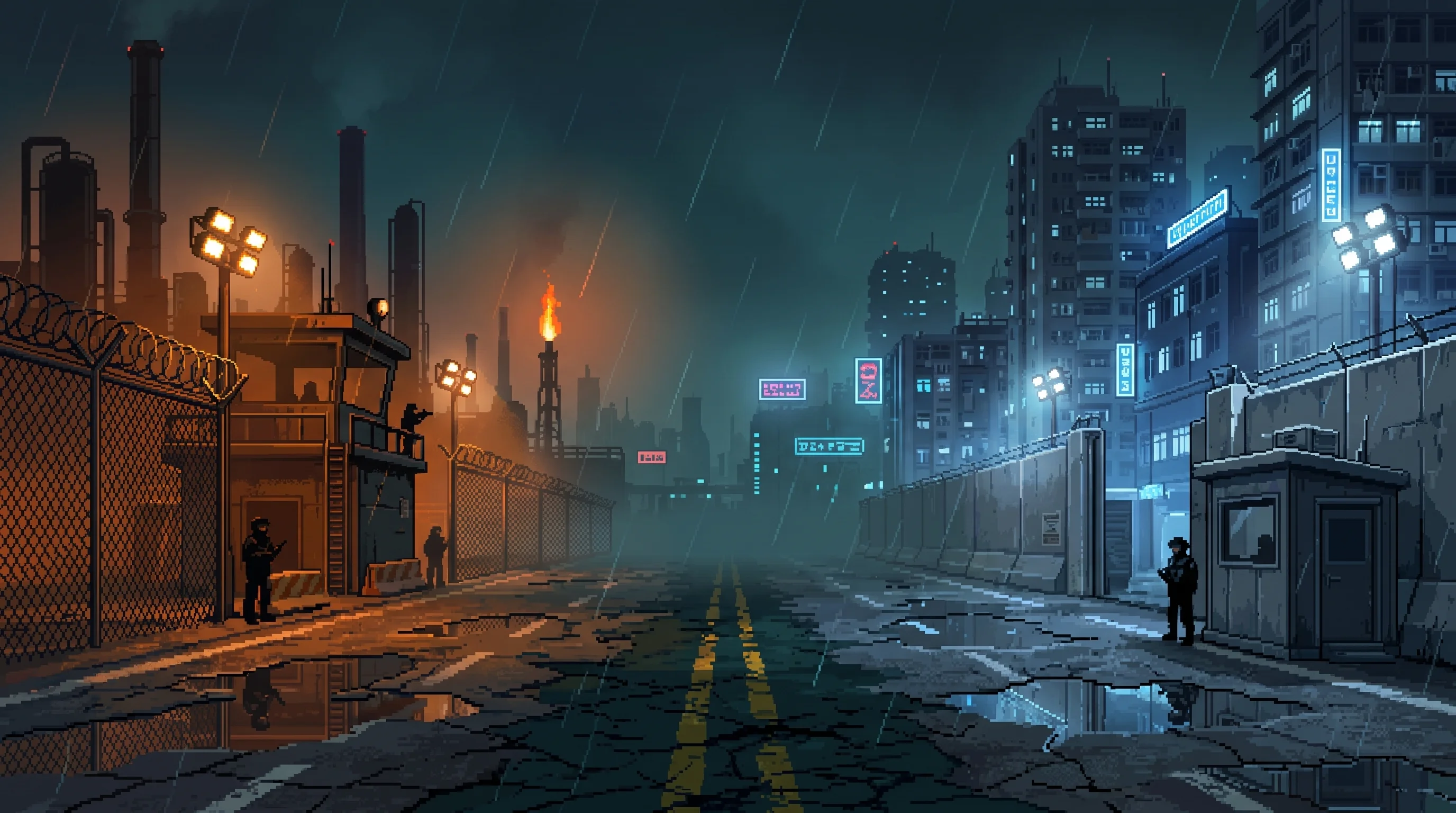
Its twin joint Ironclad-Guardian border; the same officers work both.
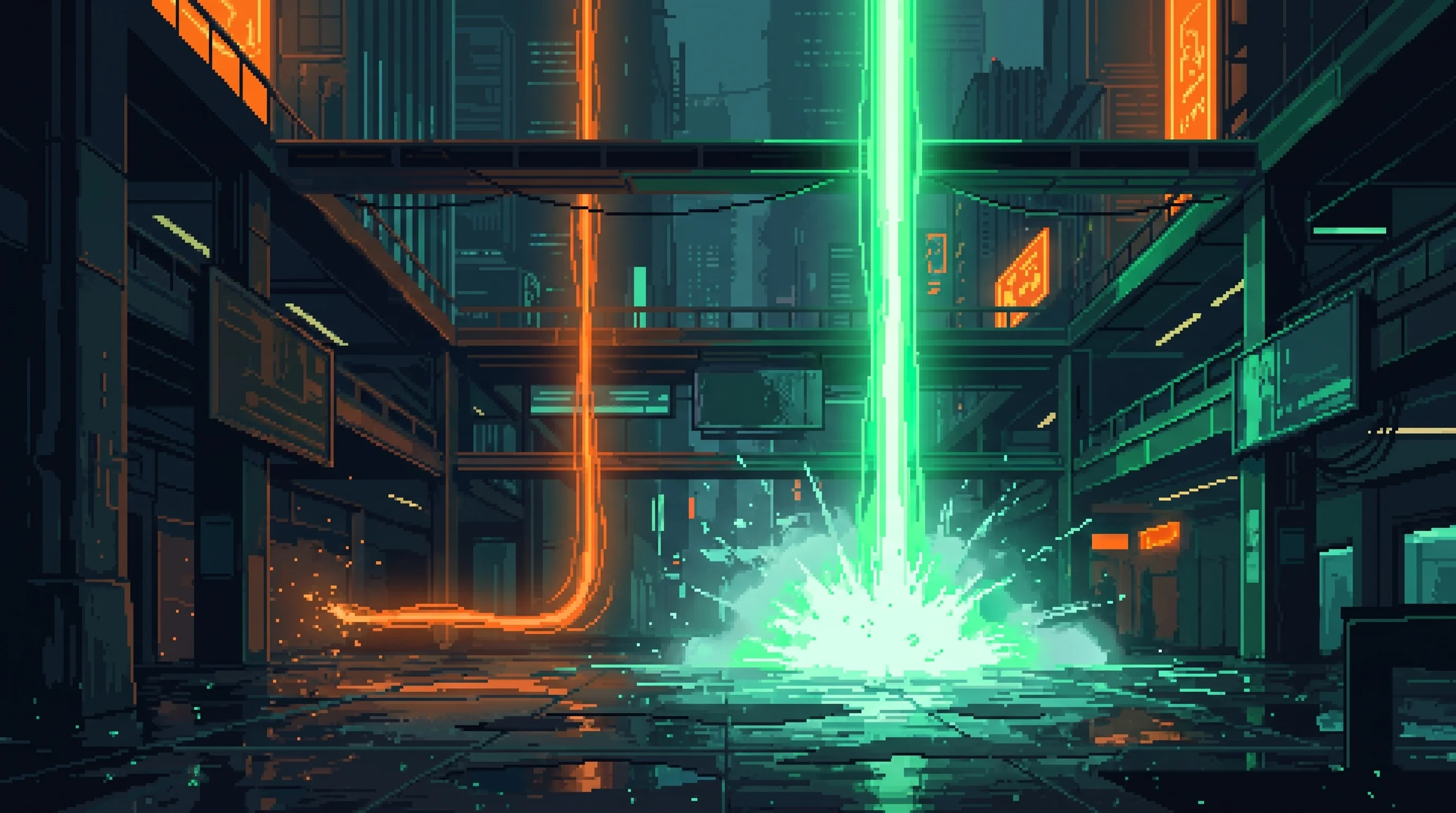
Cheap oceanfront, priced on a lifespan the files retired.
The point at which effort stopped being able to close the gap that compounding opens.

Cleared to know the fractures or qualified to assess them, never both.
When your employer is your country, quitting is emigration.

Local Intelligence Scan
Nearby Signals
CANONICAL PROXIMITY


Environmental Readout
LIVE CONDITIONS- Air
- Clean
- Light
- Fog shrouded
- Flood
- No exposure
- Heat
- Temperate
- Security posture
- Lethal restriction
- Infrastructure
- Derelict
Position Data
SECONDARY- Elevation band
- Shoreline — the Rim edge
- Lattice fix
- E-12.3 · N+10.6

—